


Introduction
This Us guide covers the 50 US states, not the 5 american territories (American Samoa, Guam, the Northern Mariana Islands, Puerto Rico, the U.S. Virgin Islands) because they're separate entities in geoguessr.
IOn order to play the USA, here are the 4 moist usefull things to learn :
-Landscapes : they give you a rough idea of your location.
-the federal road numbering system.
-the state highway shields.
-the license plates.
Once you know all of this, you can then learn specific tricks for each state.
Area codes of landlines are almost impossible to learn, because there is no logic behind it.
Landscapes
This map shows the different types of landscapes in the USA :
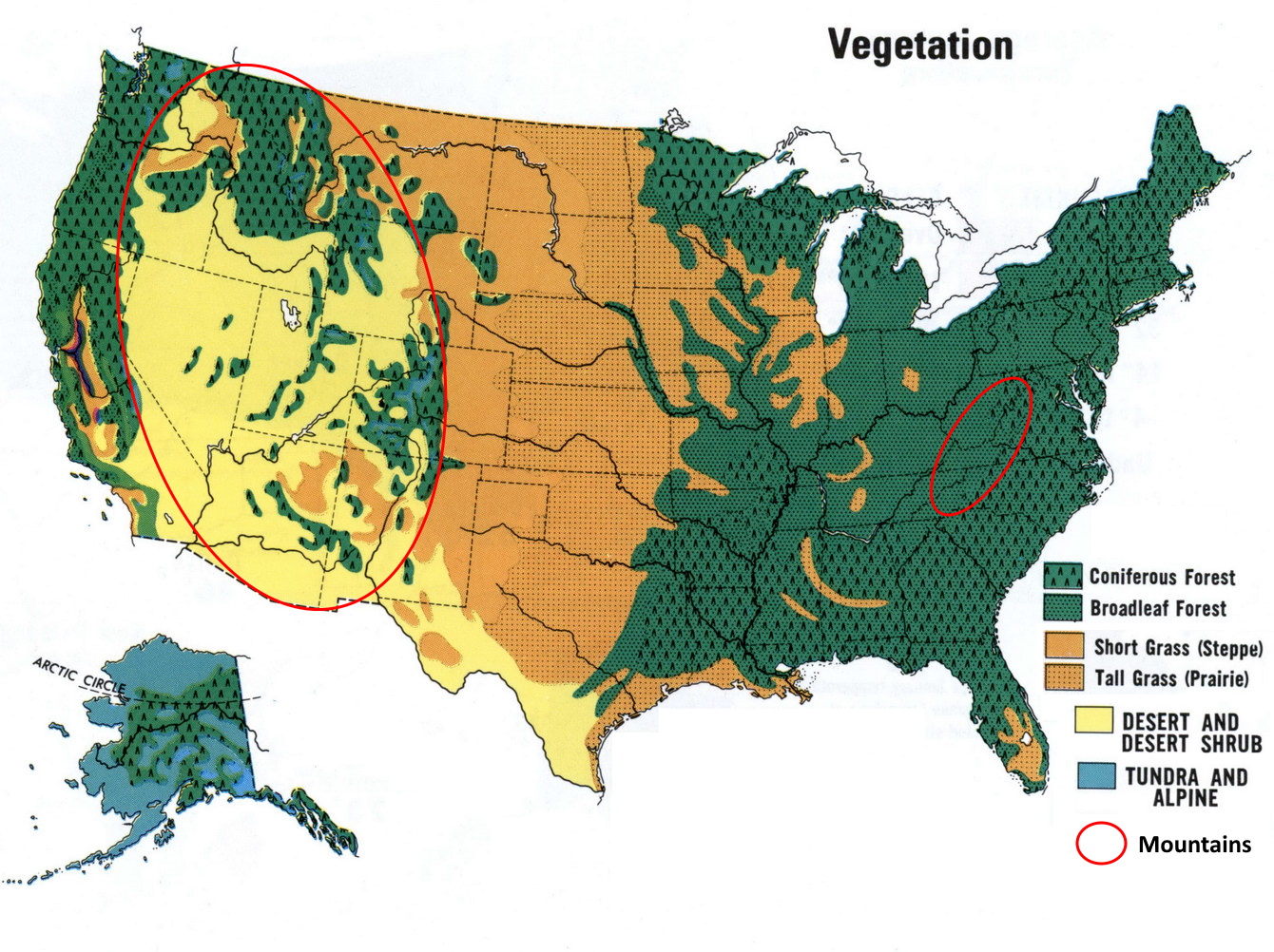
Notes :
-in the center, the great plains, with lot of agriculture. The grass gets smaller as you go west.
-The Apalachians, the only "mountain" range in the east, with its foresty hills landscape.
-Hawaï is not on the map, it is the only place with tropical forests, and also some desolate volcanic landscapes.
Interstates
Most interstates cross the whole country. Those with an even number range from 2 in the south to 96 in the north. Those with an even number range from 5 in the west to 99 in the east. Hawaï and Alaska have their own numbering system.
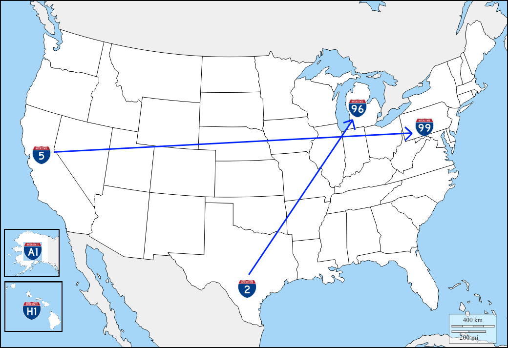
For 3 digits interstates, look at the last 2 digits, it is a branch of this 2-digits interstate, near a major city. For example interstate 205 is interstate 05 around Portland. Beware, 3 digits interstates are not unique, for exemple interstate 215 is interstate 15 in both Las Vegas and Salt Lake City.
Note: sometimes the state name is written in small letters above the interstate number.
US highways
Like the interstates, the US highways cross the whole country, they're numbered in the opposite way :
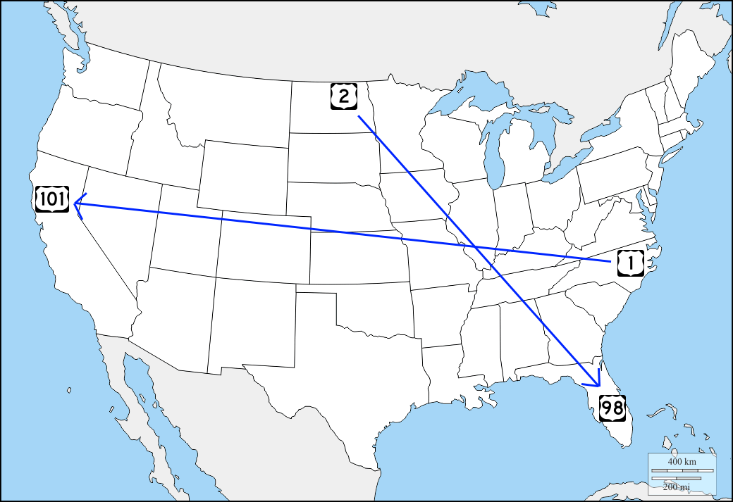
Above 101, 3 digits highways are branches of 2 digits hishways, most of the time they're qui close from their parent highway.
There are no US highway in Hawaï nor in Alaska.
More details
If you want to learn more about federal highways, this video from Chicago Geographer contains a lot of details :
State highways
State highways appear on the map in a white oval, but eaxh state has its own design for highway shields.
The State highways shields quiz gives you the opportunity to learn them.
US cities
The US cities quiz covers specifically the cities of the US.
License plates
License plates are a big tell for finding the state you're in. Most states have several different license plates and they're not that easy to learn, so i just put the easiest ones, it is already a good basis.
The 3 easiest plates
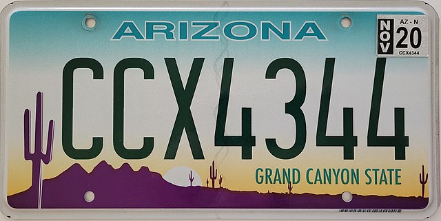
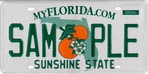
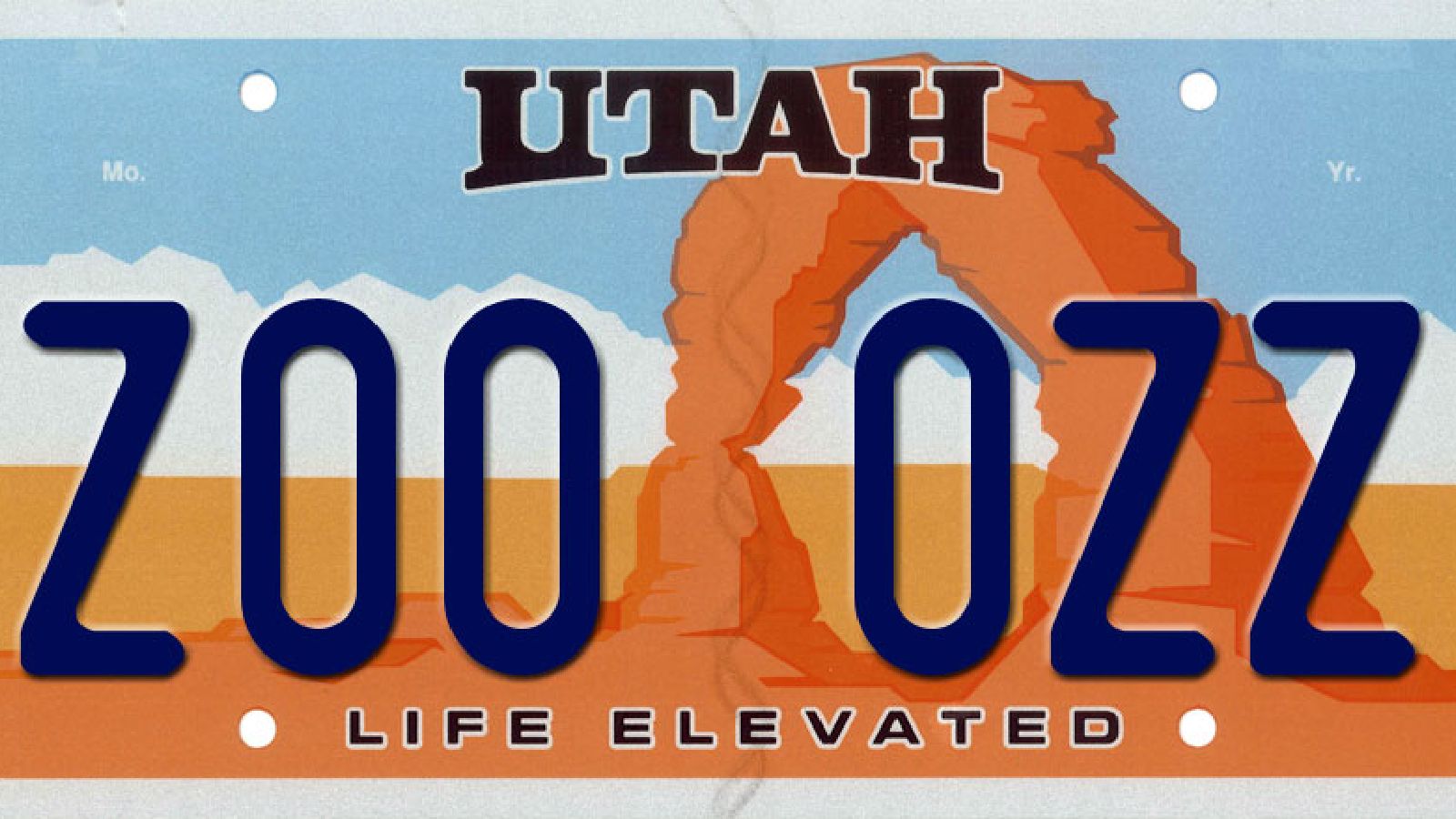
Arizona, Utah and Florida license plates are quite easy to recognize.
Here is the training map : US 3 easy plates
Arizona plates have purple in the bottom right corner.
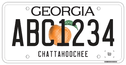
Florida plates have an orange with green leafs in the middle. Some plates of georgia look alike, with a peach instead of the orange.
Utah plates have a unique brown shape.
License plates containing yellow
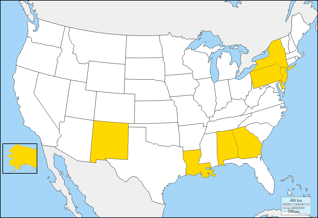
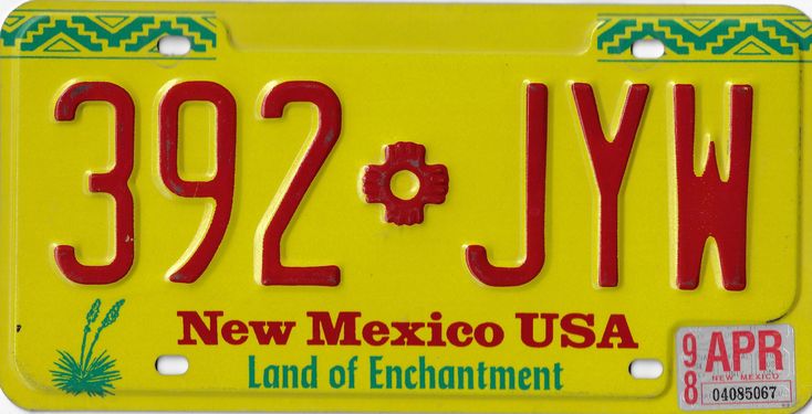
4 areas are concerned by yellow license plates : north east, south east, New Mexico and Alaska.
Here is the training map : US yellow plates
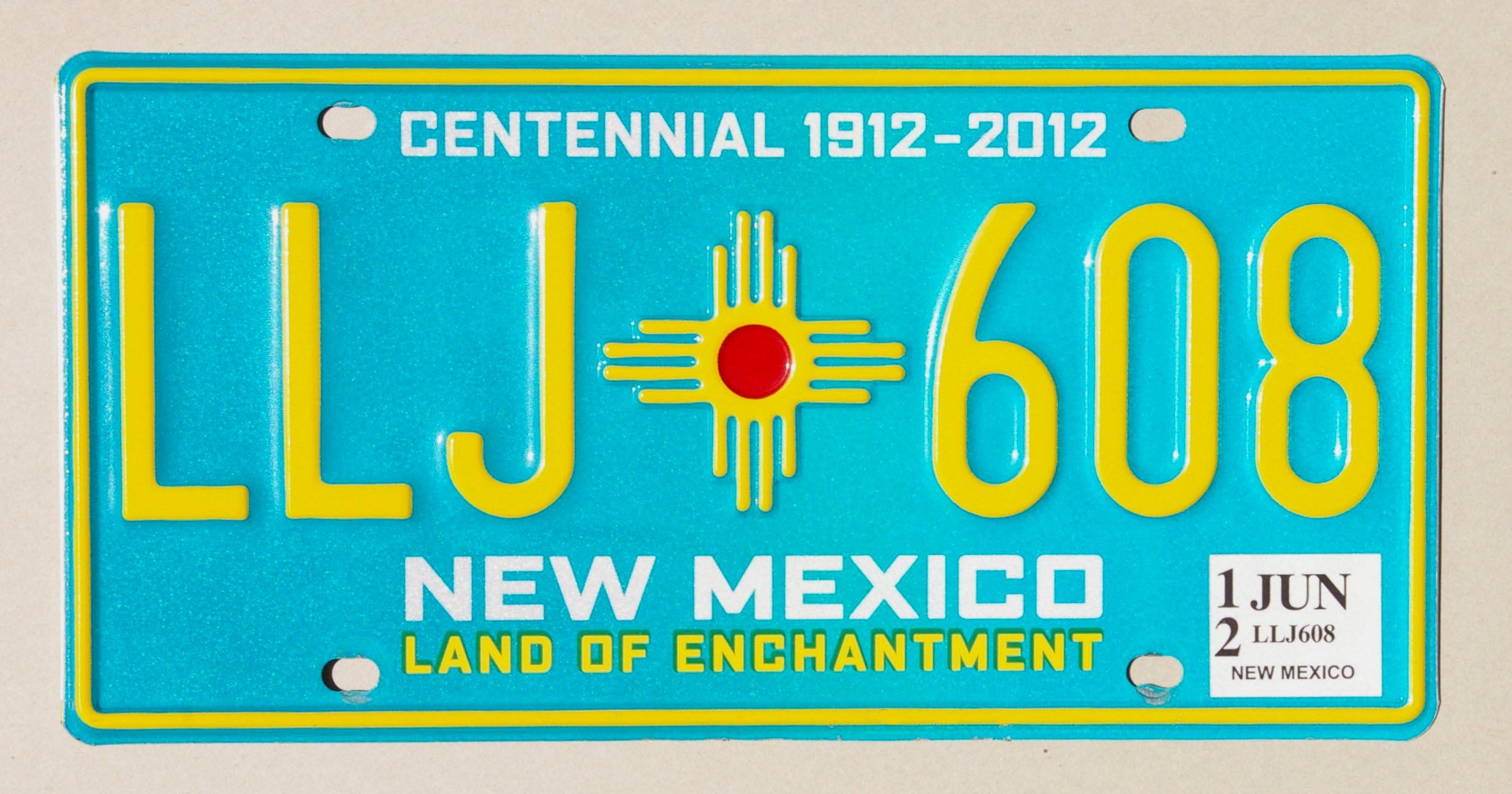
A yellow plate with a desert like feeling means you're in New Mexico.
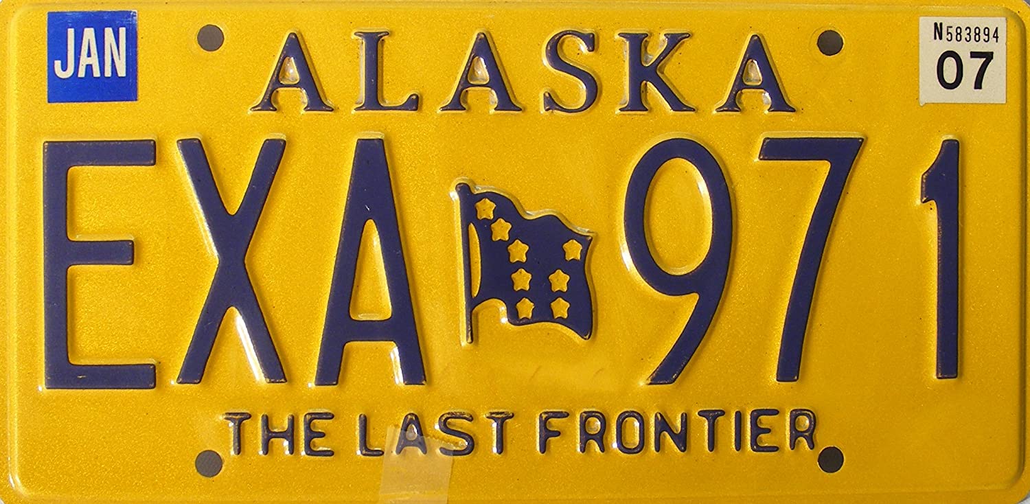
A yellow plate in a cold and mountainous environment means you're in Alaska.
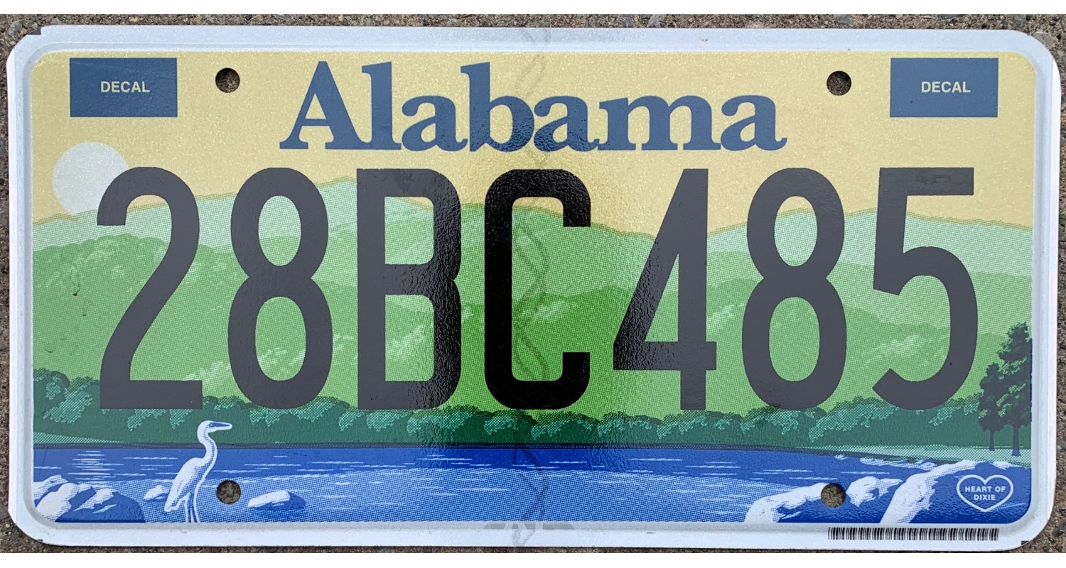
Alabama plates are yellow/green/blue.
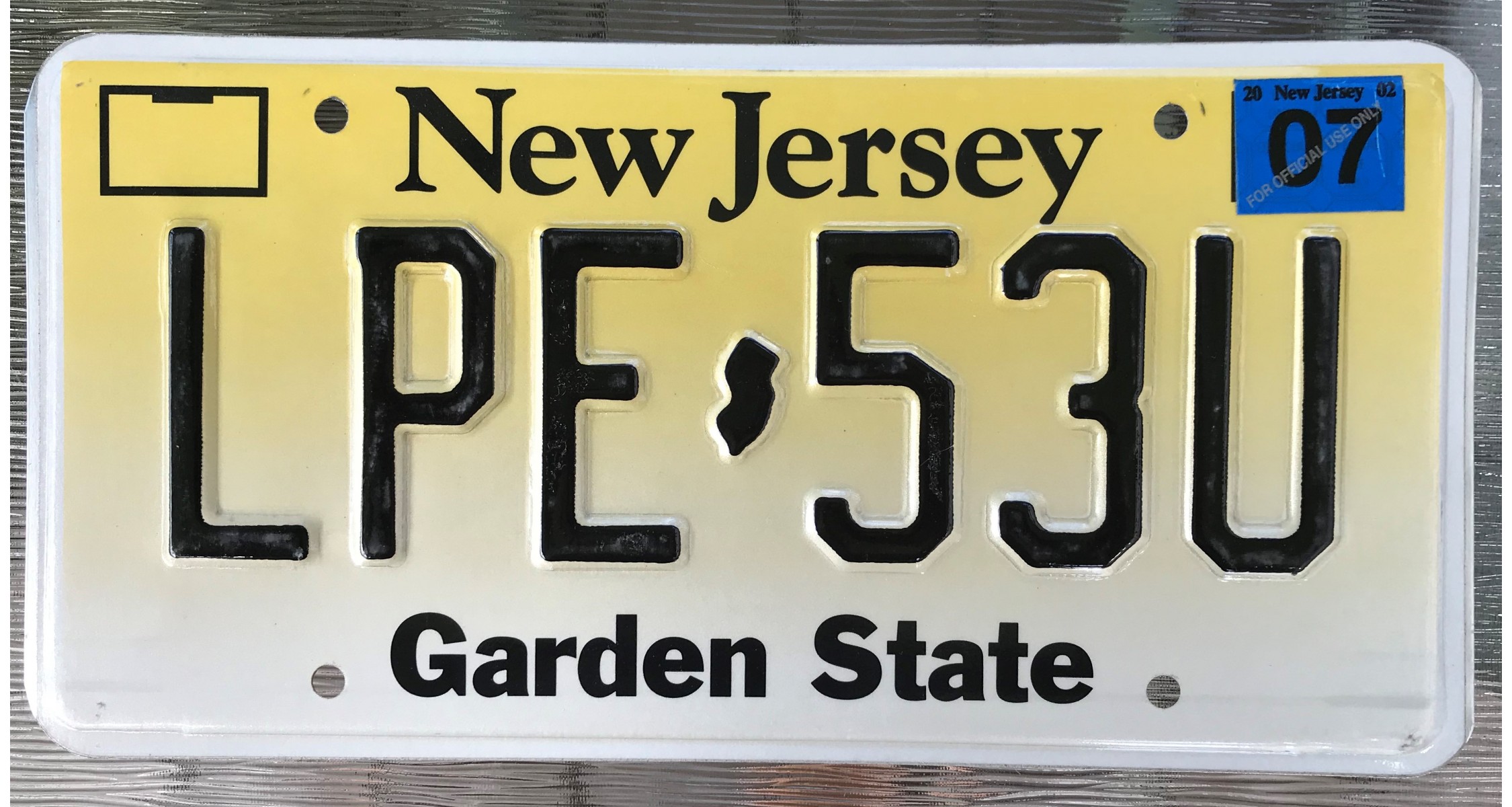
New Jersey plates are half yellow half white.
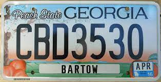
A yellow dot in the middle means you're in Georgia, but with the blurr they can be mistaken for florida license plates.
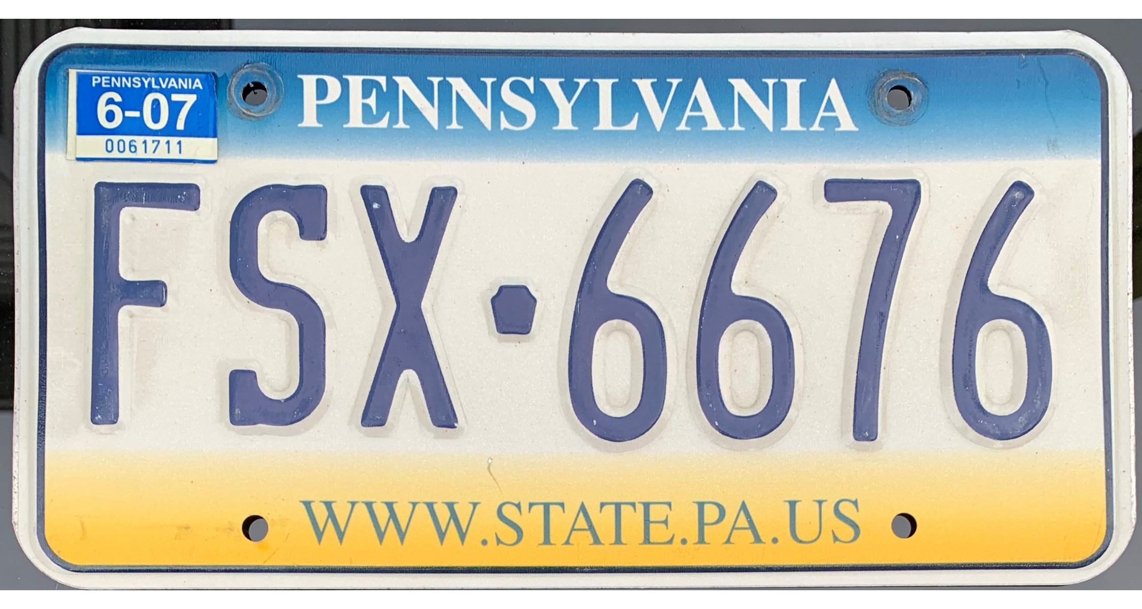
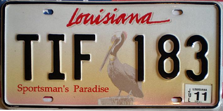
There are several blue/white/yellow plates. You will need other clues (such as the landscape) to find out wether you're in Pennsylvania, Georgia or Louisiana.
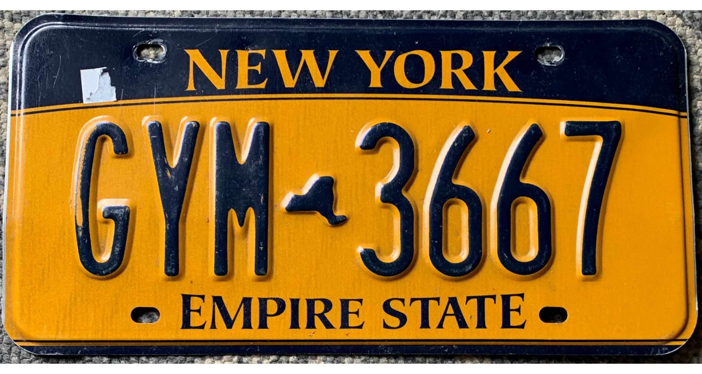
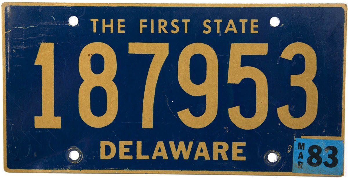
Delaware and New York license plates are fully yellow. In theory, New York license lpates are black at the top but it is not always visible.Some Delaware plates are a mix of deep blue and yellow.
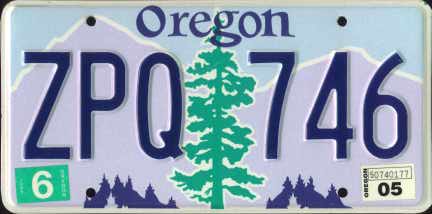
License plates containing green
You can find green license plates in 5 states.
Here is the training map : US green plates
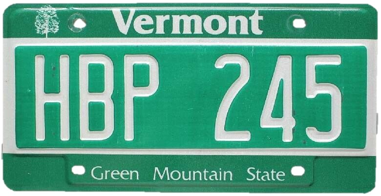
Fully green plates means you're in Vermont.
There are some fullgreenish/turquoise plates in New Mexico, even though most New Mexico plates are yellow. Anyway, you shouldn't ever mix Vermont and New Mexico, landscapes are widely different.
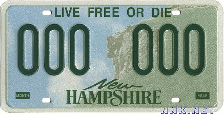
White on the left and green on the right means you're in New Hampshire.
Alabama plates are yellow/green/blue.
Oregon plates are either white or blue, but they all have a light green point in the center.
More tips
There are a lot more tips that may enable you to find which state you're in, this map list many of them : US State-Specific Clues. Read the map description for a list of the tips. The information to look at is always at the center of the screen.